Unmanned Aerial Systems Monitor Mine Reclamation Success
Often, the best way to see what’s happening on the ground is from the air and especially when the goal is to monitor the condition of large areas as they change over time.
A collaboration between Utah State University’s Remote Sensing/GIS Lab and the Utah Division of Oil Gas and Mines (DOGM) is developing an effective landscape-monitoring tool to help land managers evaluate reclamation activities across the state.
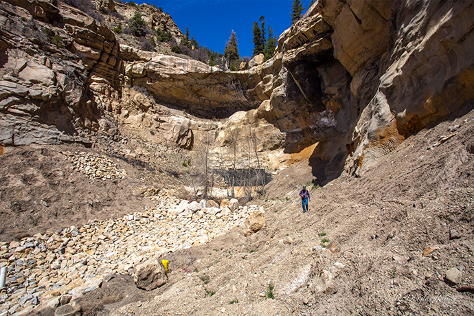
The current test site is the Wilberg-Cottonwood coal mine located near Castle Dale, Utah, which has undergone reclamation activities to return the mine site to natural conditions. It is PacifiCorp’s responsibility to do reclamation work at the site and the partnership has yielded important data and tested methods that can be applied to monitoring and managing other disturbed sites.
Drones equipped with high-resolution cameras capture images that are paired with topographic data and allow the team to monitor changes where soils were “pocked” by a trackhoe to produce thousands of micro-watersheds and support new vegetation. The approximately 13,500 pocks in the reclaimed area slow water as it moves downhill, curbing erosion and trapping water which aids nearby plants. Over time, seeded vegetation will grow and the pocks will fill with sediment, leaving the landscape in a semi-natural condition.
The aerial images allow the DOGM to monitor the landscape in detail which was not available to land managers in the past. Scientists and land managers will be able to build on the aerial and ground-based data to create a template for monitoring other reclamation sites.
Researchers involved in the project are in USU’s Department of Wildland Resources, Douglas Ramsey, professor and director of Utah State University’s Remote Sensing/GIS Laboratory, Christopher McGinty, associate professor and the lab’s associate director, and graduate research assistant Christopher Brown.